

Beneath the waters of California’s golden coast lies a long-buried prehistoric era that could change our understanding of ice-age history. According to California State Parks, after the last glacial maximum, sea levels soared by over 300 feet, flooding ancient landscapes and Indigenous settlement areas, and eventually the Pacific Ocean. With help from the San Diego Archaeological Centre, researchers are currently uncovering thousands of submerged stone tools, thereby creating a ‘lost coastal migration world.’ Meanwhile, through extensive federal expeditions led by NOAA Ocean Exploration, there are attempts to map these drowned valleys for prehistoric camping locations. These discoveries also include artefacts over 100,000 years old, including mammoth tusks, and submerged village locations.
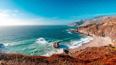
A 300-foot sea rise that changed California forever
California, at the time of its discovery, would not have been recognised as the same state that people know today. According to California State Parks, during the Ice Age, the melting ice caps caused a sea level rise of more than 300 feet. This resulted in the flooding of many miles of land, and not just water being added to the ocean. From this submerged world, many of California’s past secrets remain buried beneath the sands of the continental shelf.
Signs of ancient neighbourhoods
Imagine, when divers dive to approximately 80 feet deep off the coast of La Jolla to collect items, they can find stone tools. This is just one example of what the San Diego Archaeological Centre discovered along the coast, as they reported more than 2,000 stone mortars and pestles (or bowls used for grinding) located on the floor of the ocean.All of these artefacts are evidence that areas now submerged beneath the ocean used to be populated sites of villages and activities of Indigenous people for thousands of years.
The giant island of Santarosae
The Northern Channel Islands were one big island called Santarosae during the Ice Age because of the glaciers that linked the islands to the mainland. Scientists believe this super-island provided the first group of humans who arrived in North America with a ‘highway’ to travel on. Using sonar technology, scientists are now able to see the original outlines of ancient rivers and forests that were part of this super-island by mapping under the ocean and seeing where they used to be located before the ocean covered them.
Mammoth and Sloth discoveries
There were also several ‘megafauna’ living on land, like the ‘Jefferson’s Ground Sloth’ and mammoths, which can still be found today in fossils located at the Santa Cruz Museum of Natural History. A well-known find from Santa Rosa Island includes mammoth tusks that have been dated to be around 100,000 years old. These fossils demonstrate how giant mammals migrated, just like humans did during this period, when both were forced to migrate because of climate changes and seawater consuming their ancestral homelands.
Sonar explained: How researchers map drowned ancient landscapes
According to the detailed plans from NOAA, side-scan sonar and sub-bottom profiling sonars are used by scientists. Side-scan sonar and sub-bottom profiling sonar can be thought of as large-scale ultrasound machines used to map out the ocean. These pieces of equipment transmit sound waves through water to reach the sea floor and have the ability to generate maps that depict ‘paleolandscapes’ (hills, valleys, and riverbeds) that were on the sea floor before it was submerged under water.